October 2000 saw a fairly historic meeting of NASA Ames, US Army Aviation and Missile Command, CSC (Computer Sciences Corporation), NIICD Infrared, USDA Remote Sensing Applications Center, and USDA Fire & Aviation personnel. After much discussion and planning, it was decided to interface this new system to the RS-25 scan head.
The Phoenix System has been a long time in development. Several approaches were tried as were several hardware arrangements. Many very talented individuals were involved in the final development of this system. Phoenix operates on a Windows-based PC system, has a data acquisition system, runs on software that is specially developed for Phoenix, and utilizes the same scan head as the Flame System (RS-25).
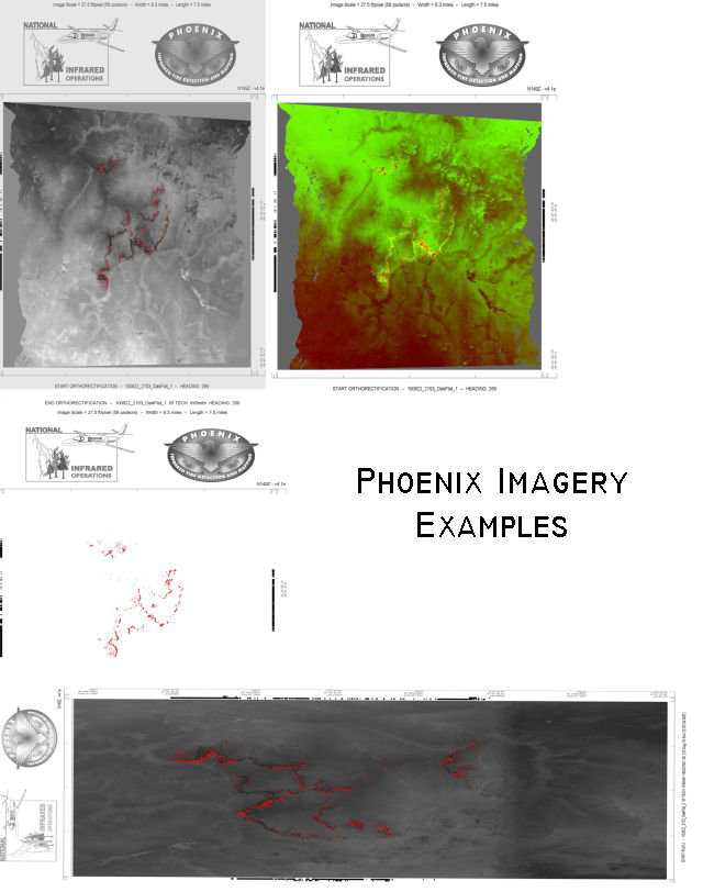
With these improvements, we will be providing extremely accurate (within 2 pixels per scan line) hot spot locations that are geo-referenced in a ".tiff" format.
Total field of view 120°
Ground coverage
6.5 Statute Miles at 10,000 Ft AGL
Detectability
8 inch 600°F Hot Spot at 14,000 Ft AGL
Fire location method
Edge marks and Pixel Enhancement, Geo-referenced .tiff files.
Geo-Tiff referenced system outputs
256 Color Grey-Scale Ortho
2 Color (False) Ortho
Fire Only Ortho
Raw Ortho
Raw Hot Spot Shape Files